It should not be assumed that this site is publicly accessible and it may be on private property. Do not trespass.
Monument details
Summary
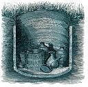
In the late 19th century late Iron Age burials were found in a sand pit in Parish Field. Some finds were discovered 200 yards (182.88m)NE of Aylesford Church. Two stone cists containing human remains were found in 1886. During the gradual working of the pit further unspecified objects were found.The area has reverted back to agricultural use.
See also TQ 75 NW 55
Images

| Grid Reference: | TQ 730 593 |
|---|
| Map Sheet: | TQ75NW |
|---|
| Parish: | AYLESFORD, TONBRIDGE AND MALLING, KENT |
|---|
Monument Types
- CEMETERY (CEMETERY, Iron Age - 800 BC to 42 AD)
Full description
If you do not understand anything on this page please contact us.
[Name centred TQ 73095924] Bronze Age burials found AD 1886, 1889 and 1898 [no siting symbol] [NAT] [TQ 72935936] Late Celtic Urnfield excavated AD 1886 [NAT] (1) [TQ 73095925] Two Stone Cists containing human remains found AD 1886 [NAT] (2) The classic 'First C' Belgic cremation cemetery at Aylesford (1st c. BC) (3) was published in detail by Evans after he had made discoveries there (which included the Aylesford bucket) in 1886, and had learned of earlier finds. The site was in a sand-pit in 'Parish Field' (centred at TQ 731593 on Tithe Map) and some of the finds were made 200 yards NE of Aylesford church, while all were recorded before 1890. Therefore the pre-1890 workings of the large pit immediately north of Aylesford are indicated; these were at the east end- see Map diagram. Evans excavated what he considered to be the western edge of the cemetery in 'a strip of hitherto undisturbed land lying along the NW margin of the pit (apparently the 'Late Celtic Urnfield excavated 1886' at TQ 72935935 on the 1938 O.S. 6", though this could be a misplotting through failure to take extension of the pit into account) and as, over a considerable number of years previously, finds had been recorded 'pari passu with the gradual excavation of the pit' the cemetery probably occupied at least the western half of the earlier workings and a little beyond these on the west. This approx. area, centred at TQ 731593, shaded green on the map diagram. (3-5) The area of the cemetery has been disused as a sand-pit for a number of years and much of it has reverted to agricultural use, while the rest is waste. (6)
<1> OS 6" 1938-48 (OS Card Reference). SKE48355.
<2> OS 6" 1898 (OS Card Reference). SKE48313.
<3> Arch 52 1890 315-88 (A J Evans) (OS Card Reference). SKE34431.
<4> Aylesford Tithe Map 1841 (OS Card Reference). SKE37421.
<5> Problems of the IA in S Britain 14 (C F C Hawkes) (ed S S Frere) (OS Card Reference). SKE48675.
<6> F1 ASP 23-JUL-64 (OS Card Reference). SKE42245.
<7> Field report for monument TQ 75 NW 21 - July, 1964 (Bibliographic reference). SKE3874.
Sources and further reading
| Cross-ref.
| Source description | | <1> | OS Card Reference: OS 6" 1938-48. |
| <2> | OS Card Reference: OS 6" 1898. |
| <3> | OS Card Reference: Arch 52 1890 315-88 (A J Evans). |
| <4>XY | OS Card Reference: Aylesford Tithe Map 1841. [Mapped feature: #19768 cemetery, ] |
| <5> | OS Card Reference: Problems of the IA in S Britain 14 (C F C Hawkes) (ed S S Frere). |
| <6> | OS Card Reference: F1 ASP 23-JUL-64. |
| <7> | Bibliographic reference: Field report for monument TQ 75 NW 21 - July, 1964. |
Related thematic articles
