It should not be assumed that this site is publicly accessible and it may be on private property. Do not trespass.
Monument details
| HER Number: | TR 25 NW 139 |
|---|
| Type of record: | Monument |
|---|
| Name: | A double concentric ring ditch visible as a cropmark |
|---|
Summary
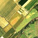
A ring ditch comprising two concentric ditch circuits is visible as cropmarks just to the north of the Little Stour at Wickhambreaux. It is part of a linear group of similar monuments.
Images

| Grid Reference: | TR 2179 5862 |
|---|
| Map Sheet: | TR25NW |
|---|
| Parish: | WICKHAMBREAUX, CANTERBURY, KENT |
|---|
Monument Types
- RING DITCH (Bronze Age - 2350 BC? to 701 BC?)
| Protected Status: | Selected Heritage Inventory for Natural England: A linear Bronze Age barrow cemetery, 150m west of Wickham Mill, Wickhambreaux |
|---|
Full description
If you do not understand anything on this page please contact us.
Four double ring ditches are clearly visible in aerial photographs 27m in diameter in a field north of the Little Stour. (1)
A double concentric ring ditch centred at TR 2179 5862 seen as a cropmark. The inner ditch circuit measured approximately 22.6m and the outer circuit approximately 32m. The southern edge of the outer circuit appears to be obscured by a darker cropmark, possibly deeper soil or alluvium. Part of a collection of what appears to be at least six Bronze Age barrows.
This ring ditch is part of a collection of five probable Bronze Age barrows forming a linear cemetery running NE-SW alongside the Little Stour. It is possible that the barrow cemetery extends further to the north-east beneath Wickhambreaux village and south-west into adjacent fields. However the area to the south-west is cultivated with orchards and so traces of buried features are unidentifiable from aerial photography as with the village. As this site has been ploughed for a number of centuries all features appear to have been levelled. It is likely that very little of the barrow structures survive, though on the southern edge of the alignment deeper soil which appears to obscure parts of some of the ring ditches may have helped to preserve more of the buried remains. (2)
An evaluation trench was created on this site in September 2008. This was to assess the overall survival and the impact of agricultural practices on the site.The trench created was 1.70m wide (NE-SW) by 23.60m long (SE-NW). Following machine excavation, a single slot was hand excavated across each of the barrow’s inner and outer ditches revealing a complete profile through each ditch fill deposits.
Both ditches were found to have very differing profiles and dissimilar infill deposit sequences. The inner ditch was found to be relatively shallow; being 0.74m deep with a rounded profile, whilst the outer ditch extended to -1.12m and had straight angled sides to a flattish slanting base. Unfortunately despite the fact that each section across the ditches revealed a good sequence of undisturbed infilling soil deposits, the precise relationship between both ditches and a possible central mound or encircling embankment, or a combination of both, is unknown. This is largely due to ploughing across the site of the barrow since at least the Roman period having removed any surviving above ground features. (3)
<1> Arch Cant 91 1975 204 (J.Bradshaw) (OS Card Reference). SKE36048.
<2> English Heritage, 2009, Wickhambreaux, Kent: Ring Ditch Survey (Unpublished document). SKE16345.
<3> Canterbury Archaeological Trust, 2008, An Archaeological Evaluation Assessment at Wickhambreaux Barrow Cemetery, Reynolds Farm, Wickhambreaux, Kent (Unpublished document). SKE16436.
<4> Weekes, J., 2012, Canterbury Archaeological Trust Interim Reports, Archaeologia Cantiana CXXXII 2012: 298 (Article in serial). SKE25119.
Sources and further reading
| Cross-ref.
| Source description | | <1> | OS Card Reference: Arch Cant 91 1975 204 (J.Bradshaw). |
| <2>XY | Unpublished document: English Heritage. 2009. Wickhambreaux, Kent: Ring Ditch Survey. [Mapped feature: #47853 ring ditch, ] |
| <3> | Unpublished document: Canterbury Archaeological Trust. 2008. An Archaeological Evaluation Assessment at Wickhambreaux Barrow Cemetery, Reynolds Farm, Wickhambreaux, Kent. |
| <4> | Article in serial: Weekes, J.. 2012. Canterbury Archaeological Trust Interim Reports. Arch Cant CXXXII: 291-305. Archaeologia Cantiana CXXXII 2012: 298. |
Related records
| TR 25 NW 442 | Parent of: An incomplete single ring ditch visible as a cropmark (Monument) |
| TR 25 NW 439 | Part of: A double concentric ring ditch visible as a cropmark (Monument) |
| TR 25 NW 441 | Part of: An incomplete single ring ditch visible as a cropmark (Monument) |
| TR 25 NW 443 | Part of: An incomplete single ring ditch visible as a cropmark (Monument) |
